Electric Vehicles
Spatial data analysis of electric vehicle charging infrastructure placementOverview
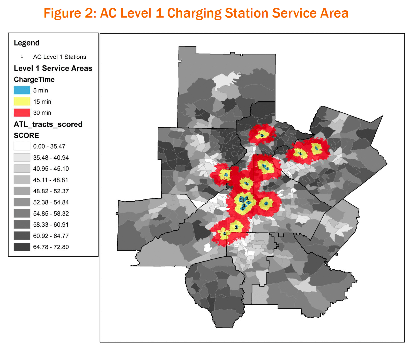
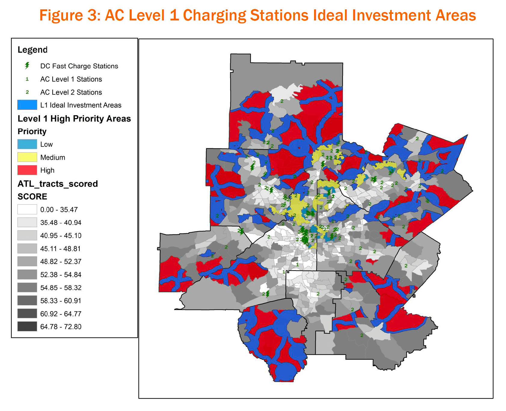
This project was built using ArcGIS to model infrastructure to support Electric Vehicles (EVs) in Atlanta, Georgia. At the start of the EV boom in the USA, drivers in the city of Atlanta were buying and leasing EVs at a rate 5x the national average, but the infrastructure in the city lagged behind in providing public charging stations to support this new mode of transportation. This project aimed to combine demographic data around the city with commuter data to highlight areas in the city that would likely see the most EV growth and the commuter paths they would need to support around the city given current charging capacity.
Analytical Concepts
- Predictive Buyer Model calculates respondents who bought electric vehicles alongside their demographic information to predict the ideal demographic characteristics of future buyers
- Mapping predictive buyer model results
- Mapping current capacity of infrastructure
- Identifying ideal areas for future investment in infrastructure
Data Stack
- PostgreSQL
- ArcGIS


